How your crop is growing
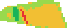
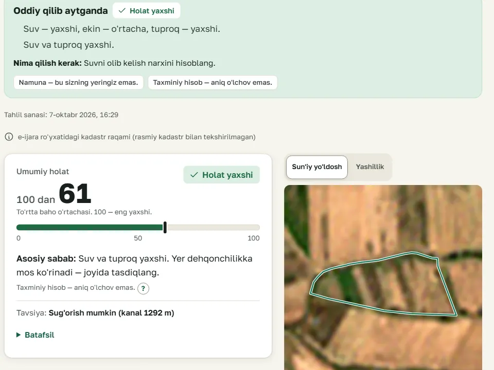
Live nowEach month has a greenness score for the field. You see when the crop grew and when the land was bare. Compare the greenest month with the latest one.
More
- June 2026 — greenest month
- September 2026 — latest month
Write your question in the Telegram bot or on the site. The AI agronomist looks at your field's weather and satellite images. It tells you whether to irrigate, spray or fertilize today. You can also send a photo of a sick leaf.
Write your question in the bot or on the site. The AI agronomist answers from your field's weather and images.
A land passport is a data page, not an official document.

No need to water now. The soil has enough water: moisture 28.8%. Check again tomorrow.
On the website you mark “Done” or “Not done”.
How it works
You add your field once. When you open the app, the data updates. We work out the rest.
A new image of the field arrives about every 5 days. On cloudy days the image is late. The smallest square on the image is 10 × 10 metres.
From the image we work out how green the field is. We add weather, soil moisture and the pest stage. This is an estimate, not an exact measurement.
Open the app or bot to see what to do today. For example, whether to water or which day is good for spraying. Mark what you did with the “Done” button on the website.
You make the decision. We give data and advice.
For farmers
Everything is on the “My fields” page and in the Telegram bot. Adding a field uses no analysis. The Farmer plan is free.
Each month has a greenness score for the field. You see when the crop grew and when the land was bare. Compare the greenest month with the latest one.
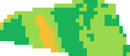
Pick a month and a colour image of the field appears. Red is almost bare, yellow is sparse, green is dense crop. Each square is 10 × 10 metres.
The image does not say why a spot is weak. Go and check: water, pests or fertiliser.
June 2026 — greenest month
September 2026 — latest monthWe compare your field with the land around it. If greenness fell everywhere, the cause is likely shared: heat or harvest, for example. If it fell only on your field, check water, pests and fertiliser.
This is only a flag, not the cause. Check on site.
In the sample, greenness fell on the field and on the land around it. The cause is shared, not only yours.
From the weather we work out when a pest reaches a dangerous stage. The list has 47 pests and 2 kinds of wheat rust (a fungus disease). We warn you early about strong heat, frost, heavy rain and wind.
This is an estimate, not an exact measurement. The satellite does not name a disease.
Open the app or bot to see today's step for your field. We tell you if you need to water and which day suits spraying. If nothing is urgent, we say so. When you do it, tap “Done” on the website.
This advice is based on weather. Look at the field yourself too.
No need to water now. The soil has enough water: moisture 28.8%. Check again tomorrow.
Choose what is planted in the field. Then spraying and harvest tips will appear.
We give the possible harvest as “from … to …”. You write down money spent on seed, fertiliser, water and work. We work out profit or loss.
Harvest is an estimate. Not a promise: the harvest may differ.
In one place
Data about land is scattered across many places. We gather it on one page. Each number shows its source and date.
Each result has a confidence level: A — high, B — medium, C — low. It depends on how much data we found.
For organisations
Data on each plot in one place: boundary, area, 12 months of greenness, risks. The farmer's personal data only with their consent.
We do not give a credit score, a credit limit or a collateral value. Only a licensed appraiser values collateral. The organisation makes its own decision.
| Data | For the farmer | For the organisation |
|---|---|---|
| Land: boundary, area, location | Live now | Live now |
| 12 months of greenness and comparison with neighbours | Live now | Live now |
| Expected harvest (estimate) | Live now | Testing |
| Costs and income (written by the farmer) | Live now | Testing |
| Next year's planting plan | Later | Later |
| Seed and fertiliser list for the plan | Later | Later |
| Credit score and collateral value | Not offered | Not offered |
Land and greenness are open data. An organisation sees the harvest and costs only with the farmer's permission. Boundaries are not checked against the official cadastre.
“Before lending: is the land there, and is it used?”
Checking many plots, the loan land list and API are on the Business plan. Price by agreement.
“What did the field look like in the month of damage?”
These tools also help insurers. There is no separate insurance product yet.
“What are the weather and drought risk in the district?”
Connected by agreement. The state gets only combined data, never personal data.
“Which farmer needs help, and when?”
We do not sell fertiliser or machinery.
Leave your name and phone number. We will call and work out together what you need.
Only the AgroRisk team sees this data. We use it only to contact you. To block spam, we also store your computer's address (IP). To ask for deletion: gulom@agrorisk.uz.
Now and later
We say openly what works and what is planned. We give no dates for plans.
On the website or in the bot. You can use it today.
Built. Switched on when a pilot with an organisation starts. A pilot is a short trial.
Next in line. No fixed date.
In our plans. Not started yet.
The satellite sees the field in squares of 10 × 10 metres. A drone takes pictures much closer. Then weak spots and damage are easier to see. There is no drone data today. There is no date or partner yet.

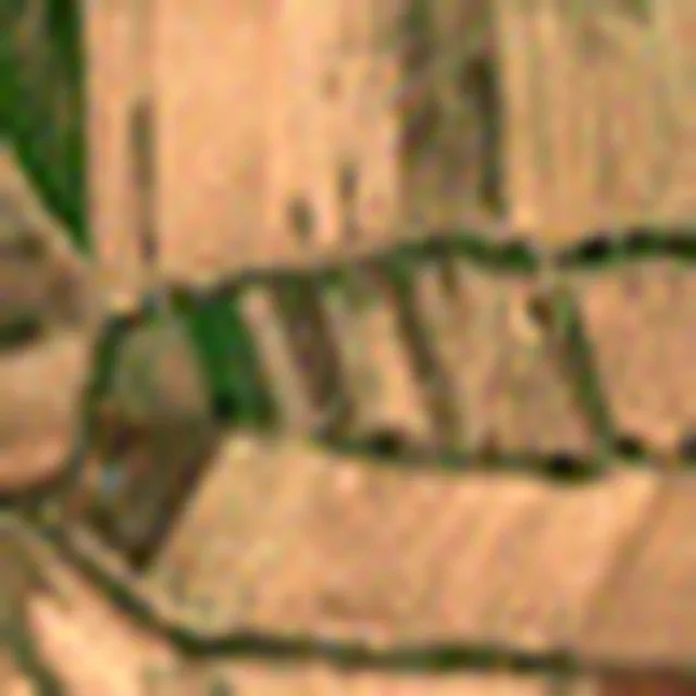
A diagram, not a real image. Contains modified Copernicus Sentinel data 2026.
Check it yourself
See a real land analysis without signing up. It is marked “Sample”. A land passport is a data page, not an official document.

This is a map measurement, not a field survey.
1 hectare (ha) = 100 × 100 metres
No outside organisation has checked our risk score yet.
Pricing
A farmer gets 3 free analyses every 30 days (1 analysis = 1 land passport). Adding a field to “My fields” uses no analysis.
Farmers and dekhkan households watching their own land.
3 analyses every 30 days (1 analysis = 1 land passport). Adding a field to your list uses no analysis.
Broker, agronomist, land buyer, small investor.
Paid for 30 days. It includes 30 analyses.
For banks, leasing and insurers. Helps check pledged land and insurance damage. Does not give a collateral value.
300 analyses every 30 days · we agree the price
We agree the Business price together, based on how many plots you check. We do not give a collateral value: a licensed appraiser sets it. Specialist is paid every 30 days.
You cannot pay on the site yet. Message @BuGulomBoy on Telegram and we will switch the plan on for you.
Often asked
AgroRisk is a service that watches fields through satellite images. It shows farmers how the crop is doing and today's step. It gives banks and organisations land data in one place. A land passport is a data page, not an official document.
A new image arrives about every 5 days. On a cloudy day there is no image, so it can be late. In the app you see the latest cloud-free image with its date.
Yes. Pick a month and a colour image of the field appears. Red and yellow spots are bare or sparse. Each square is 10 × 10 metres, so rows are not visible. The colour image is in the land passport, after you sign in.
Yes, from a leaf photo. Send a photo of the sick leaf to the Telegram bot. If it is not sure, the bot says “I cannot tell for certain”. The satellite does not name a disease. If the field gets weaker, we say “go and check”. We work out the dangerous stage of pests and rust disease from weather. It is an estimate.
On the “My fields” page and in the Telegram bot, with the “Today” button. A morning message from us is coming soon. The advice is based on weather. Look at the field yourself too.
A bank, insurer or shop sees your own records only with your permission. That means which field is yours, the crop, the harvest estimate and your costs. You can see who looked and when. You can take back permission at any time. We do not sell personal data. Plot boundaries, satellite images and greenness history are open data. Anyone who knows the cadastre number can see them.
Land data: boundary, area, 12 months of greenness, risks. The farmer's costs and harvest estimate (forecast) only with their consent. We do not give a credit score or a collateral value. The organisation makes its own decision.
It is in our plans, but there is no date. There is no drone data today. With drones, weak spots could be seen from closer up.
The “Accuracy” page shows on how many plots each number was checked. Its weak points are written there too. No outside organisation has checked our risk score yet. Estimates are given as “from … to …”.
How right our numbers are — the Accuracy pageWith Telegram. 1. Press “Sign in with Telegram” on the site. 2. Press “Start” in the bot. 3. Press “✅ Yes, it's me”. The site continues by itself. No bank card needed.
Sign in with Telegram and add your field. Free for farmers.
Satellite and weather · In Uzbek, Russian and English · 3 free analyses every 30 days